Onerahi/Onerahirahi has a rich history of settlement and development with significant Māori heritage sites and later interesting and diverse European development shaping the area.
The name Onerahirahi (‘the beach of quick overhearing’) relates to the Māori legend of Reipae and Reitu, and has been shortened to Onerahi. Land for the development of a township was purchased in the 1860s from Tipene Hari of Ngati Kahu and Te Tirarau Kukupa of Te Parawhau. Initially known as Grahamtown, with the opening of the railway in 1911, the name was changed to Onerahi.
The early 1800s saw settlers digging for kauri gum here. From the 1890s Limestone Island Cement Works meant that workers lived at Onerahi with shops and services developed to support the growing community. The development of the wharf in 1910 and rail infrastructure allowed the area to have a busy railhead.
By the 1920s the arrival of the railway, the development of a formed road (Cliff Street) up to the plateau and the closing of the Limestone Island cement operation resulted in the residential and commercial focus moving from the foreshore to Domain Road. From 1938 the airfield was a key influence on the growth on the area, including its use for war purposes.
Google Map of Early Onerahi Heritage Trail
*Note – Some points on the map are in approximate placing due to not having an address.
1) Airmail Service
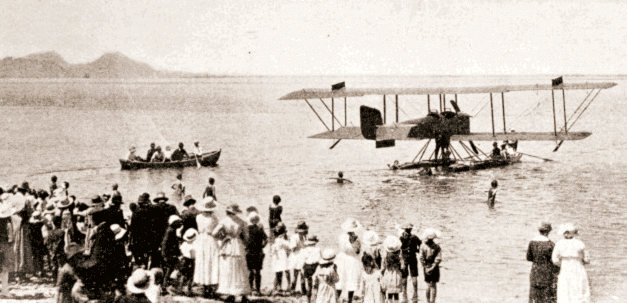
The first airmail service landed at Onerahi on 1 March 1920. The plane was piloted by Mr V. Walsh and Mr G. Bolt and the flight from Auckland took 78 minutes. This was the first time an aeroplane had been seen near Whangārei and a large crowd gathered to witness its arrival. From 1967-1972 a Sunderland flying boat was situated on the foreshore where the toilet block now stands.
2 ) Onerahi Railway
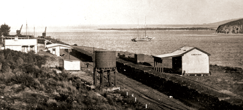
Work began on a four mile extension of the existing rail line to Grahamtown (Onerahi), in 1900. The Gull Roost Bridge across the harbour was completed in 1904 and the Onerahi Wharf was opened on 3 October 1911. Originally trains for passengers and goods ran once during weekdays, once on Saturday and twice on Sunday. Controversy reigned with the train timetable ot at convenient times for passengers and the Gull Roost Bridge having only a 30 ft gap for the lifting span not the 50 ft span designed. May 1927 saw passenger services cease and goods trains stopped in 1933. The railway station, goods shed and three houses were the last items to be built for the Onerahi Railway. The stone wall in front of the house on the hill behind the station can still be seen.
3) Onerahi Wharf
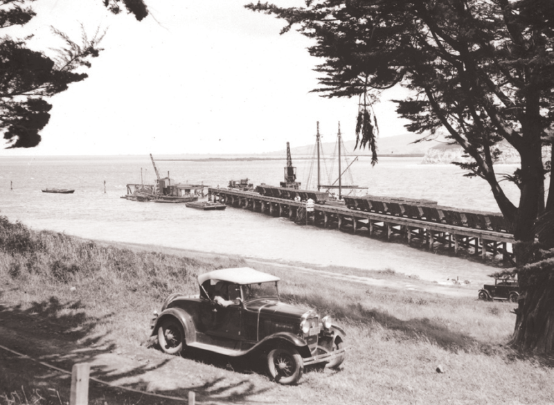
Timber for the Grahamtown (Onerahi) Wharf began arriving in 1904 but real progress was not made until 1910. The wharf was more than 1,100 ft (340m) long. For the first 500 ft it went out obliquely from the beach then turned parallel to the shoreline for the last 600 ft. The wharf was heavily used. In 1915 120,000 tons of coal, 4,200 tons of general freight and 22,000 passengers on the daily boat to Auckland went through the wharf. With the final closure of the railway in 1933 the wharf was dismantled and used in the development of the new wharf at Kioreroa.
4) Onerahi Regatta / Yacht Club
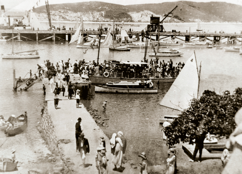
The first Onerahi Regatta was held on New Year’s Day 1911. Nearly 4,000 attendees is recorded as the largest gathering with swimming, yachting, rowing, motorboat races, and novelty events such as the ‘greasy pole’. After 1931 the annual regatta moved from New Year’s Day and limped on in a much-reduced format. The Onerahi Yacht Club was formed in 1952 and the current clubrooms were built in 1965 using blocks from the disused cement works on Limestone Island.
5) Onerahi Seawalls
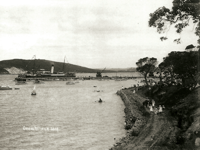
Stone retaining walls were constructed adjoining the Onerahi foreshore in 1917. The sea walls allowed the building of Beach Road and its subsequent protection. Given the active coastal system the walls have required numerous repairs and an extension of the coastal walls was undertaken in 2014.
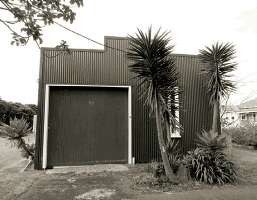
6) Going Boarding House and Store
In 1911 Henry Going built a boarding house and a general store of native timbers on the Onerahi foreshore opposite the now Yacht Club. It appears that the store was leased by a Mr Bradley and it burnt down in September 1912. The boarding house was for single workers who commuted to Limestone Island by launch. Many years later it was converted to 15 flats and was known as Mansion House. Sadly this fine old place burnt down in 1959.
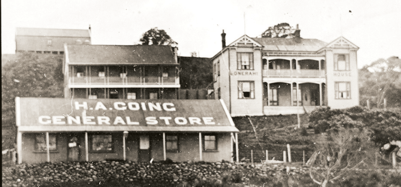
7) A E Hollay General Stores
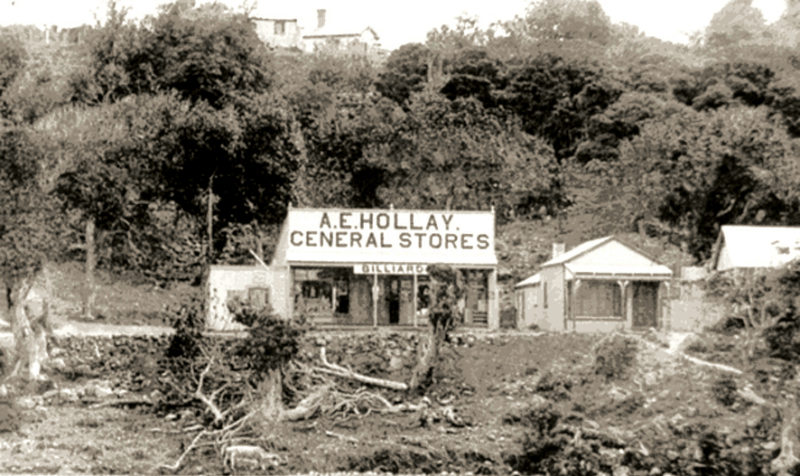
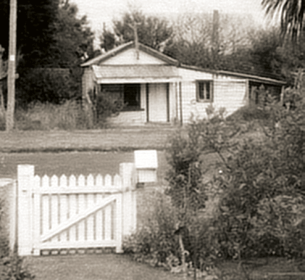
A E Hollay General Stores was located around 190 Beach Road and there was also a butchery and bakery in this area. In the 1920s the store was owned by Fred Frogley who later relocated it to Domain Road as the commercial focus moved from the Onerahi foreshore. The track in front of the house is still there and is in regular use by locals.
8) Onerahi Post Office
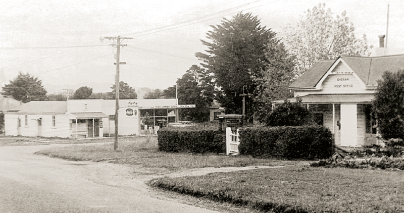
In 1916 the house on the eastern corner of Church Street and Domain Road was purchased by the post office and converted into the new Onerahi Post Office. The house was later moved across the road to 9 Domain Road.
9) Butchery / Bakery
On the corner opposite the post office was Shipman’s butchery. The bakery was next to it and was built some time before 1920 when Arthur Graham bought it. Later it was owned by the Ford family.
10) General Store
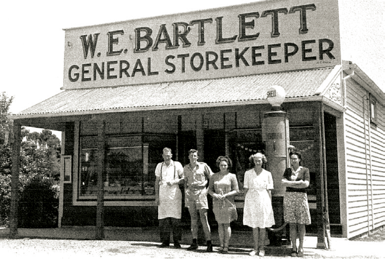
Bill Bartlett bought the general store from Fred Frogley in 1940. The store was open 40 hours per week, including Saturday mornings. On Wednesday afternoons deliveries were made to Whangārei Heads residents. The store closed when the new shopping centre at Sherwood Rise was developed in the mid-1950s.
11) Book Club
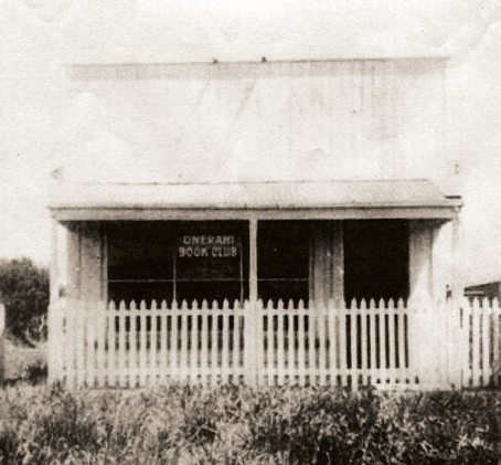
Set up in the front room of 15 Domain Road by Zelma Frogley in the late 1930s, and later continued by Frances Dent until 1963. The book club had over 200 titles.
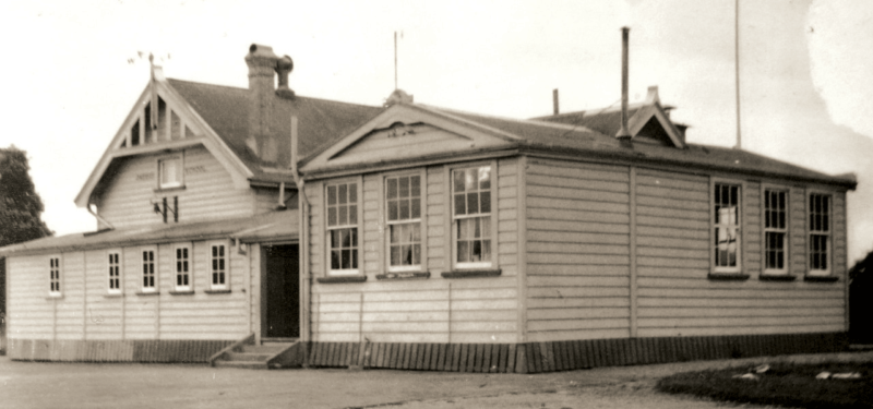
12 ) Town Hall and the Domain
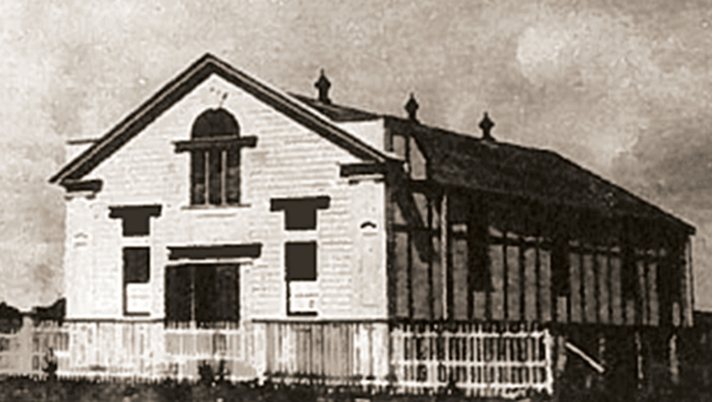
The Onerahi Town Hall was officially opened on 14 October 1915. For half a century the Town Hall played a key role in the life of the community. The advance group of Air Force personnel who arrived in 1942 used the hall or temporary accommodation. The hall was demolished in the 1960s, about the time the airport was extended. Further along Domain Road from the hall was the Domain which comprised of tennis courts, football, hockey, croquet and cricket fields. When the airport was extended in 1939, the playing fields had to be relocated.
13) Bus Depot
The bus service began after the closure of the railway for passenger traffic in 1927. By that time the road from Whangārei had been upgraded. The last bus of the day from Whangārei was garaged in this building (now 6 Domain Road) and used for the first service in the morning. A small sign on the front of the building notes it as the Grahamtown Bus Depot.
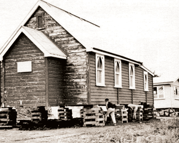
14) St Stephen’s Church
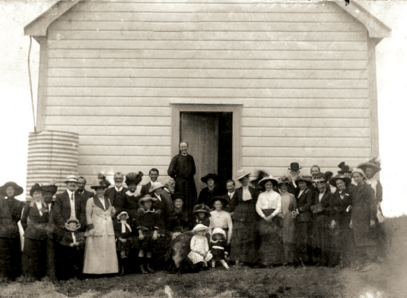
St Stephen’s Church was built in 1910. Prior to this, the congregation used to meet in the Mission Hall, built in 1895 and sited about Mason Street. The church porch was added in 1922 and the hall in 1956. The church was lowered in 1995 to align with the level of the hall.
15 ) WW1 Oak Tree Memorial
In 1921 the Whangārei Beautifying Society planted an oak tree for each of the dead soldiers from the Onerahi district. In the 1990s following approaches from some residents the Whangārei District Council resolved to cut the trees down. However this was successfully opposed and a commemorative plaque placed on the site.
16) Tennis Club
In 1914 the Onerahi Tennis Club opened new courts on the Domain playing fields at the end of Domain Road. When the airport was constructed the Public Works Department built courts for the tennis club on its present site on Ormiston Road and these were opened in October 1939.
17) Tirarau’s Land
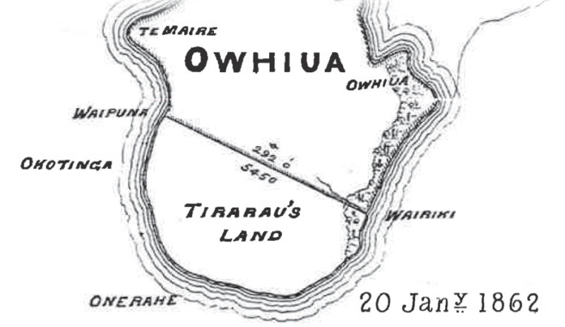
The block of Te Parawhau hapū’s land, labelled Tirarau’s Land on the 1857 survey, was sold in 1863 for £500. A number of sections remained in Tirarau’s name after subdivision. The boundary line of the land sold by Te Parawhau follows a line from Waipuna (by Johnson Street), across in a line to Waiariki Stream which tumbles down Ormiston Road. This line influenced the alignment of streets in the subdivision of the Onerahi plateau and can still be seen on survey maps underlying the airport.
18) McKenzie Avenue and Track
The topography of Onerahi created the need for ‘zig-zag’ footpaths to connect the beach to the plateau. In 1920 the McKenzie Avenue zig-zag was constructed 6ft wide and completed with a layer of shells. McKenzie Avenue originally traversed Church Street and formed one of the roads extending across the current airport land.
19) Onerahi School
In 1905, the single room Onerahi school building was moved from the top of Cartwright Road to a site between Church Street and McKenzie Avenue. From 1942-1945 air force hangars were sited at the end of the school’s football field, and trenches were built nearby for students to hide in the event of attack. The school building was demolished in 1963 to make way for airport extensions.
20) St James Church
St James Church was built in 1939 and originally sited at (now) 131 Church Street. With the developments along Sherwood Rise, the church was moved to its current location in 1966.
21) Stevens Point
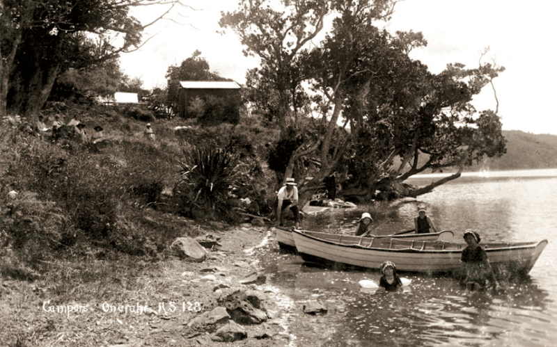
Stevens Point was named after Chief Tipene of Waikaraka, who played an important role in early European settlement. Tipene died in 1881 and his canoe was set up as a memorial on this site. The early 20th century saw several camp sites and baches here, as Onerahi was a seaside destination. In 1926, the area was first gazetted for protection as a Scenic Reserve, however debate was then held on the need for a road to connect Waikaraka and Beach Road. The current Scout Den was built in 1962.
22 ) Groynes
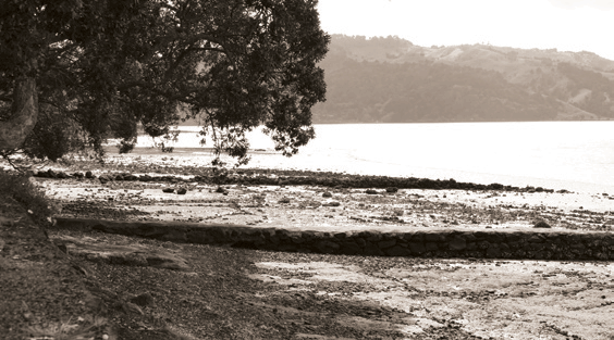
In the early 1920s, four groynes were constructed along the beachfront as a means of creating sandy beaches. Made of stones and well cemented walls and tops at a cost of £15-20 each, the groynes enabled swimming as a regular activity for Onerahi school children.
23) Mullet Cannery / Red House
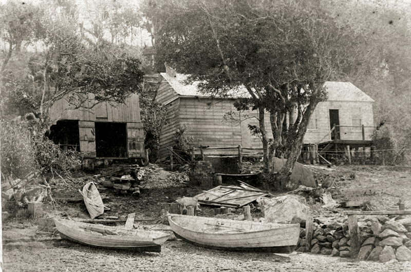
In the 1880s Walter Mason started a small unsuccessful mullet cannery in the south end of the house (140 Beach Road) due to the plentiful fish stock in the harbour. Post 1889 the cannery was revived by the Handforth brothers supplying canned mullet for troops in the Boer War. In the 1950s the Toebes family painted the house red. It is now known as ‘Red House’ and is an icon of the Onerahi foreshore.