The best coastal swimming hole in Northland?
If you thought you’d seen all of Northland’s best swimming spots, think again. At the end of the Motutara Recreation Reserve headland near Whananaki North is one of the coast’s best-kept secrets; a spectacular natural rock pool that locals have visited for generations. This stunning turquoise pool sheltered by a rocky outcrop offers some of the most unique swimming on the Northland coast. The catch? You’ll need to earn it with an up-and-down walk across farmland and through coastal scenery that’s every bit as rewarding as the destination itself… and then scramble down a rocky cliff. Visiting the Rock Hole requires a moderate degree of fitness, and you’ll also need to be confident enough to climb down a few metres of steep rocky cliff before you’re near the water.
Getting There: The Journey Through Motutara Farm
Located about 45 minutes drive northeast of Whangārei, Whananaki is that rare coastal settlement that still feels genuinely off the beaten track. Unlike the more heavily promoted Tutukaka Coast beaches, Whananaki rewards those willing to venture a bit further from the main tourist routes.
From Whangārei, head north on State Highway 1 for about 35km (22 miles) before turning left onto Whananaki North Road. The turn-off is well-signposted, and from here it’s another 15 minutes of winding country roads through rolling farmland and pockets of native bush before you reach Whananaki village.
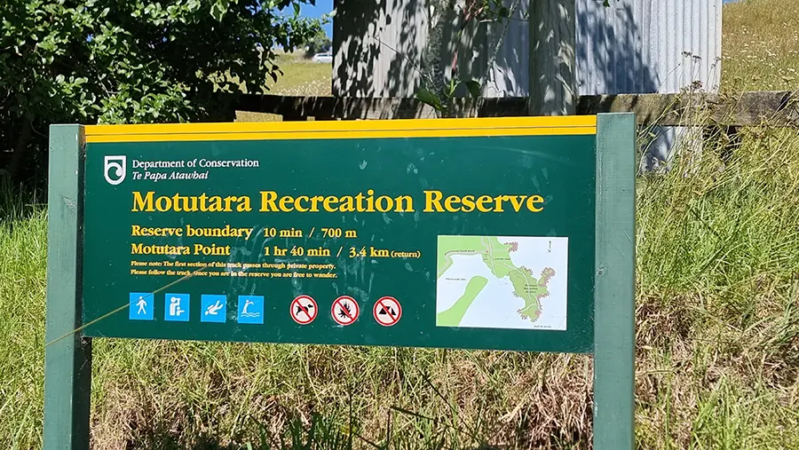
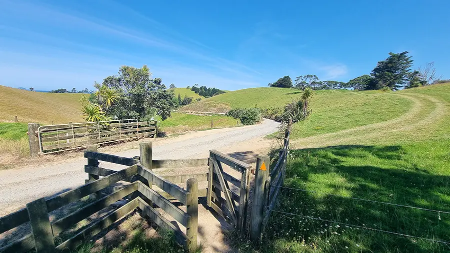
The start of the Motutara Recreation Reserve Track is signposted from Rockell Road at the base of a hill in Whananaki village, just as the road begins to climb, heading towards Otamure Bay. Parking is limited to roadside spaces near the track entrance, so be considerate when parking and don’t block any gates or driveways. During busy summer weekends, you might need to park a bit further back along the waterfront, like I did, and walk to the start of the trail.
The Motutara Farm Track: What to Expect
The track to the Rock Hole is officially listed as 3.4km return (about 2 miles), taking roughly 1 hour 40 minutes for the round trip. However, this estimate assumes you’re heading straight there and back. In reality, most people spend considerably longer exploring the various beaches, viewpoints, and of course, the Rock Hole itself.
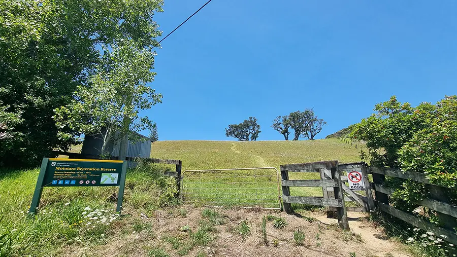
The walk begins by climbing steeply through private farmland. This first section is on a farm track that can be muddy after rain, so proper footwear is essential. Jandals (flip-flops) won’t cut it here – you’ll want decent walking shoes or trainers with some grip as the worn grass track can be slippery whether wet or dry. The track is well-defined but quite exposed, so on hot summer days, start early or bring plenty of sun protection and water.
As you climb, you’ll get your first glimpses of the magnificent Kings Beach below, part of the Motutara Farm camping area. The views out to the Poor Knights Islands on the horizon are spectacular on clear days. The track eventually joins a gravel road that runs through the Motutara Farm campsite – New Zealand’s most spectacularly located campground, with sites perched on cliffs overlooking three different beaches.
Stay on the defined track as you pass through the camping area. The campground operates during summer months and can be busy, but campers are generally friendly and used to walkers passing through. Once you reach the bottom of the hill on the far side of the campground, near the coastline on the south side of the headland, you’ll find the continuation of the track marked on your right.
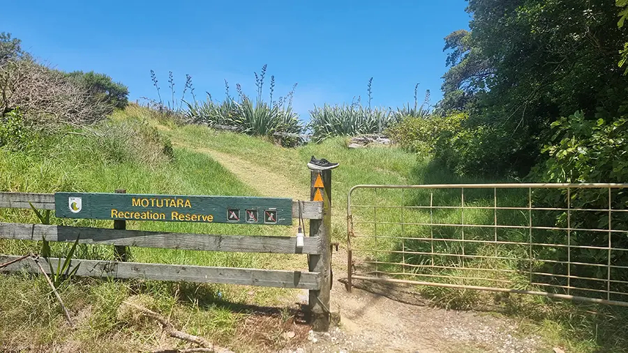
Through the Reserve: Where the Magic Begins
Once you enter the Motutara Recreation Reserve Walk at the southern end of the campground, you’ll be immediately distracted by an entrance to another beach through some flax bushes. The track continues through farmland, following the ridgeline with increasingly stunning coastal views. This is where the walk gets really special. You’re high enough to see the full sweep of the coastline, with white sand beaches tucked into rocky coves below, and the Pacific Ocean stretching to the horizon.
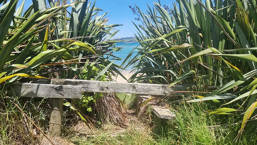
The track soon rounds a ridge, revealing another unnamed beach below that makes you want to abandon the mission and scramble down for a swim right there. Resist the temptation! The Rock Hole is worth holding out for. This section of the headland has a network of mown tracks through the farmland, not all of which appear on official maps. The main route is generally obvious, following the ridgeline towards the end of the peninsula.
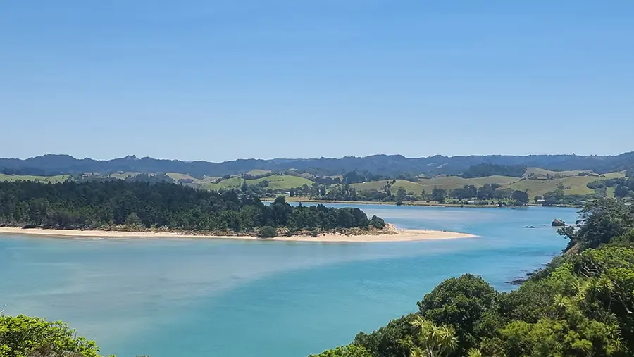
From various vantage points along the ridge, you’ll have expansive views across Whananaki Inlet to the west, with the rolling forested hills of Northland providing a stunning backdrop, and down the coast towards Sandy Bay and Matapouri to the south. The white sand beach of Whananaki South is particularly striking from this elevation, sweeping around the harbour entrance in a perfect arc.
The track eventually descends towards a secluded beach, another gorgeous spot worth exploring. Pohutukawa trees line the clifftops here, providing dramatic framing for photographs and welcome shade on hot days. From the far end of this beach, the track continues up a small valley before climbing to a Pohutukawa-lined clifftop with views down onto rocky shores.
How to get to the Rock Hole
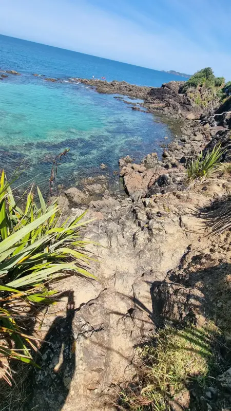
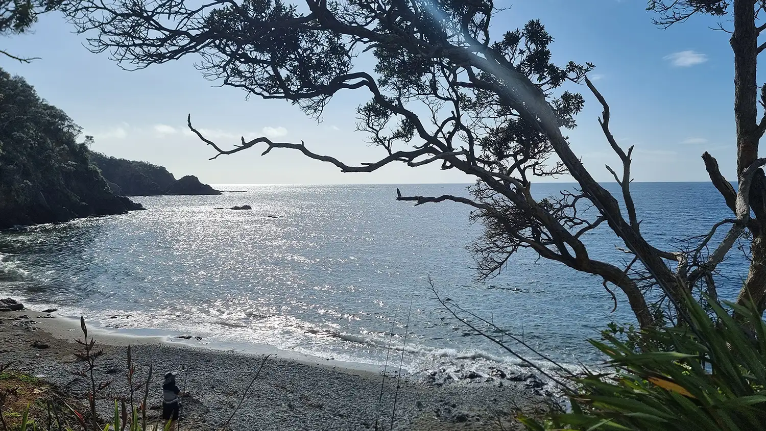
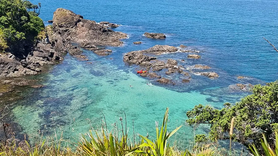
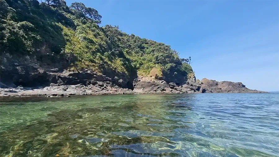
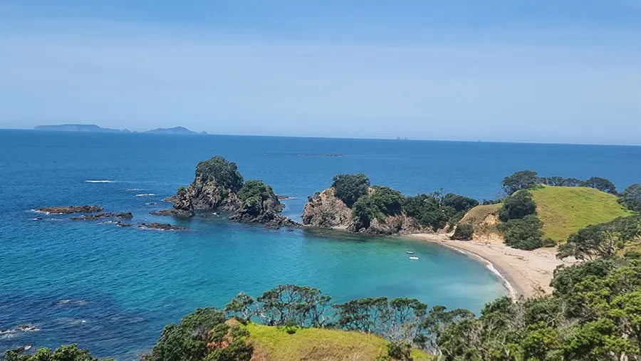
As you approach the end of the peninsula, watch for a side track that leads down towards the tip of the headland. This is where you’ll find the Rock Hole, though it might take a moment to spot it – the lagoon sits in a natural depression, sheltered by rocky outcrops that protect it from the open ocean. The final descent is down a rocky cliff. Be very careful that you have stable foot and hand holds when climbing down.
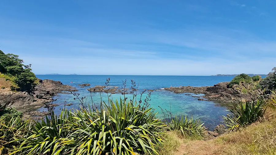
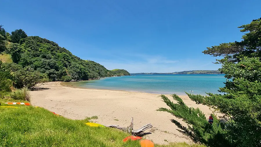
The Rock Hole is genuinely stunning. Imagine a large natural pool with the most incredible turquoise water you’ve ever seen, sheltered by a rocky outcrop that breaks the ocean swell. The water clarity is exceptional, and the combination of white sand visible through the clear water and the dark rocks creates that vivid aquamarine colour that seems almost too bright to be natural.
At the seaward edge of the lagoon, there’s a deep rock pool that locals use for jumping, though you should assess conditions carefully before attempting this yourself. The depth varies with the tide, and what’s safe at high tide might be dangerously shallow at low tide. If you’re not absolutely certain about the depth, stick to entering the water from the rocky edges where you can see the bottom. I visited at high tide and the water was at least 2.5m (8+ feet) deep.
Swimming and Snorkelling: Crystal-Clear Conditions
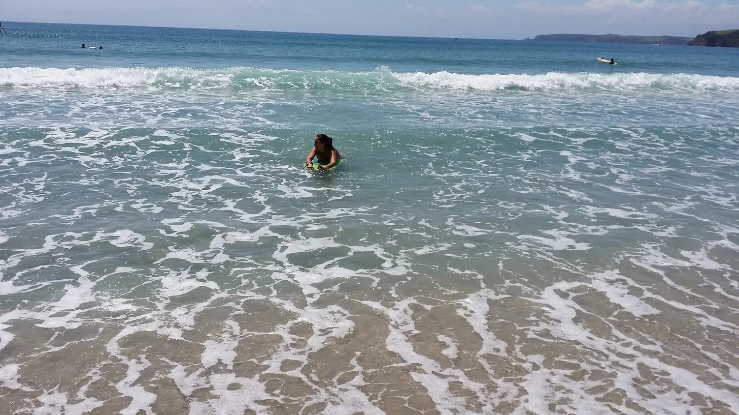
The Rock Hole offers some of the best swimming on this stretch of coast, and it’s quite different from beach swimming. The rocky shoreline that shelters the lagoon creates relatively calm conditions even when there’s a decent ocean swell running. The water is usually a few degrees cooler than at sheltered sandy beaches, but it’s incredibly refreshing on hot days.
The clarity of the water here is outstanding. You can see the bottom clearly even in the deeper sections, and snorkelling is absolutely worthwhile. Bring your gear and explore the rocky edges of the pool where marine life congregates. You’ll spot various fish species, sea anemones, crabs, and other creatures that thrive in these rock pool environments. The sheltered nature of the lagoon means you can snorkel safely even if you’re not a particularly confident swimmer.
The best time to visit is within a couple of hours either side of high tide. At low tide, the rock pool is still swimmable but considerably smaller, and accessing it requires more careful rock scrambling. At high tide, the lagoon is at its most impressive, with more swimming area and easier access from multiple points around the rocky edge.
One important consideration: this is an ocean-influenced rock pool, not a completely enclosed lagoon. While the reef provides excellent shelter, larger swells can still send water washing over the rocks, and conditions can change quickly if weather deteriorates. Always check the swell forecast before heading out, and if there’s a big southerly or easterly swell running, save this trip for another day. Safety always trumps Instagram photos!
The Secluded Beaches: Hidden Treasures
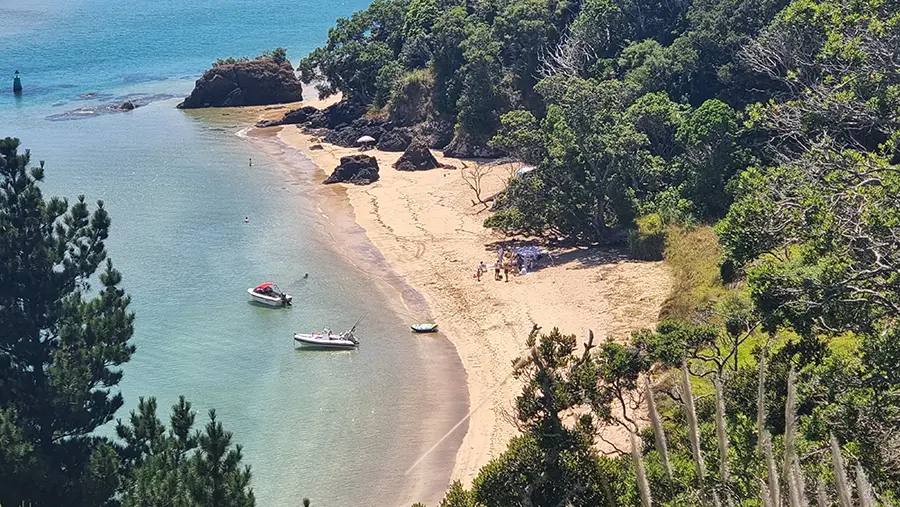
The Rock Hole might be the star attraction, but the journey there reveals several other stunning spots that deserve exploration. The various small beaches you’ll encounter along the headland are genuinely secluded. On weekdays or outside peak summer, you might have them entirely to yourself.
The unnamed beach you pass on the way to the Rock Hole is particularly beautiful, with white sand and rocky outcrops that create interesting pools at low tide. It’s sheltered from prevailing winds and offers good swimming when conditions are calm. The steep descent down from the ridge track means most casual walkers give it a miss, which is precisely what makes it special.
There’s also “Toki’s Beach” mentioned by locals, another hidden gem within the reserve. These beaches don’t have the easy access or facilities of more developed spots like Matapouri or Whale Bay, which is exactly their appeal. Bring everything you need; water, snacks, sun protection, and a bag for your rubbish, because there’s nothing out here except pristine coastline.
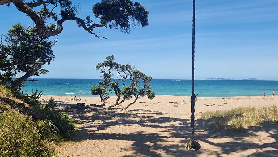
On the way back, walk through the campsite to King’s Beach and take a dip to cool off. It’s a stunning spot with Pohutukawa for shade and even a couple of tree swings!
Wildlife and Natural Features
The Motutara Reserve headland supports a surprising variety of native and introduced species. The Pohutukawa trees are magnificent, particularly during their Late November-January flowering season when the headland blazes with red blooms against the blue water. These trees provide crucial habitat and food for native birds.
You’ll likely hear and see Tūī, especially in summer when the Pohutukawa are flowering. Fantails are common along the bush sections of the track, and you might spot Pīwakawaka (fantails or grey warbler) in the scrubbier areas. The coastal cliffs provide nesting sites for various seabirds, and you’ll often see shags drying their wings on the rocks below.
The rock platforms and pools around the lagoon host typical New Zealand intertidal zone species. At low tide, you can explore these areas to find sea stars, various small fish species, crabs, and the usual array of molluscs. Please resist the temptation to remove shells or disturb marine life. Leave everything where you found it for others to discover and enjoy.
Be aware that wasps and wasp nests may be present in this area, particularly in the warmer months. They’re attracted to the combination of water, flowering plants, and general bush areas. If you encounter a nest, give it a wide berth and don’t disturb it. Anyone with severe wasp allergies should carry appropriate medication and consider whether this walk is advisable during peak wasp season (January-March).
Facilities and Practical Information
The Motutara Recreation Reserve is essentially undeveloped, which is part of its charm but also means you need to be self-sufficient. There are no toilets, no drinking water, no rubbish bins, and no emergency services nearby. Here’s what you need to know:
- Facilities: None at the Rock Hole itself. The closest facilities are back at the Motutara Farm campground (for campers only) or in Whananaki village.
- Water: Bring plenty. You’ll need at least a litre per person for the walk, more if it’s hot or you’re planning to spend time at the Rock Hole. There’s no drinking water available along the track.
- Rubbish: Pack in, pack out. There are no rubbish bins, and there shouldn’t be. Take all your rubbish with you.
- Sun Protection: Critical. Much of the walk is exposed farmland with little shade. Bring sunscreen, a hat, and consider a rash vest for swimming to avoid burning.
- Footwear: Proper walking shoes or sturdy trainers for the track. Consider bringing reef shoes or old sneakers for the Rock Hole if you want to explore the rocky areas more confidently.
- Communication: Mobile coverage can be patchy in this area. Download offline maps before you head out, and let someone know your plans.
Safety Considerations
While the walk itself is rated easy and suitable for most fitness levels, there are several safety considerations to keep in mind:
- Track Conditions: The farmland section can be very muddy after rain. The track becomes slippery, and you’ll need appropriate footwear. After heavy rain, consider postponing the trip.
- The Rocky Climb Down: This is not that high (a few metres – 20ft), but it is very steep and you need to be careful that you’re standing on or holding onto stable rock. The rock in this area is prone to breaking apart.
- Weather: This exposed headland catches the full force of easterly and southerly swells. Check the marine forecast, not just the land weather. Big swells make the Rock Hole unsafe for swimming.
- Tides: While the Rock Hole is accessible at most tides, it’s considerably better around high tide. Check tide times before you go. Low tide exposes more rock and makes entry more challenging.
- Jumping: If you’re tempted to jump from the rocks into the deep pool, check the depth first. What’s safe at high tide might be dangerous at low tide. When in doubt, don’t jump.
- Heat: Summer temperatures on this exposed coastline can be brutal. Start early or go later in the day. Bring way more water than you think you’ll need.
- Solo Travel: While many people walk this track alone, it’s always safer with a companion, particularly if you’re swimming. If you do go solo, tell someone your plans and expected return time.
- Private Land: The first section passes through private farmland and the Motutara Farm campground. Respect property, stick to the marked track, and leave gates as you find them.
Best Times to Visit
- Summer (December-February): Peak season and with good reason. The weather is reliably warm, the Pohutukawa are flowering, and the Rock Hole is at its most inviting. However, this is also when the track is busiest and the Motutara Farm campground is full. Weekdays are considerably quieter than weekends.
- Autumn (March-May): Potentially the best time. Water temperatures remain pleasant through March and often into April. The crowds thin dramatically after school holidays end, and you’ll likely have the Rock Hole to yourself. The light takes on that beautiful golden autumn quality that makes photography spectacular.
- Spring (September-November): Variable weather but can be lovely. The coast is green from winter rains, wildflowers appear, and birds are active. Water temperatures are still cool in September but become more comfortable by October. This is an underrated time to visit.
- Winter (June-August): Generally too cold for comfortable swimming (water temps around 15-16°C), but the walk itself is still worthwhile for the views and solitude. You’ll have the track almost entirely to yourself. Storm watching from the headland can be dramatic, though check conditions carefully before venturing out.
Nearby Attractions and Activities
Whananaki itself is worth exploring beyond the walk to the Rock Hole. The village is divided into Whananaki North and Whananaki South, connected by the longest footbridge in the Southern Hemisphere; a 395-metre wooden structure built in 1947 to allow school children from Whananaki South to attend school on the north side. Walking across this historic bridge is an experience in itself, and it provides access to more beautiful coastal areas.
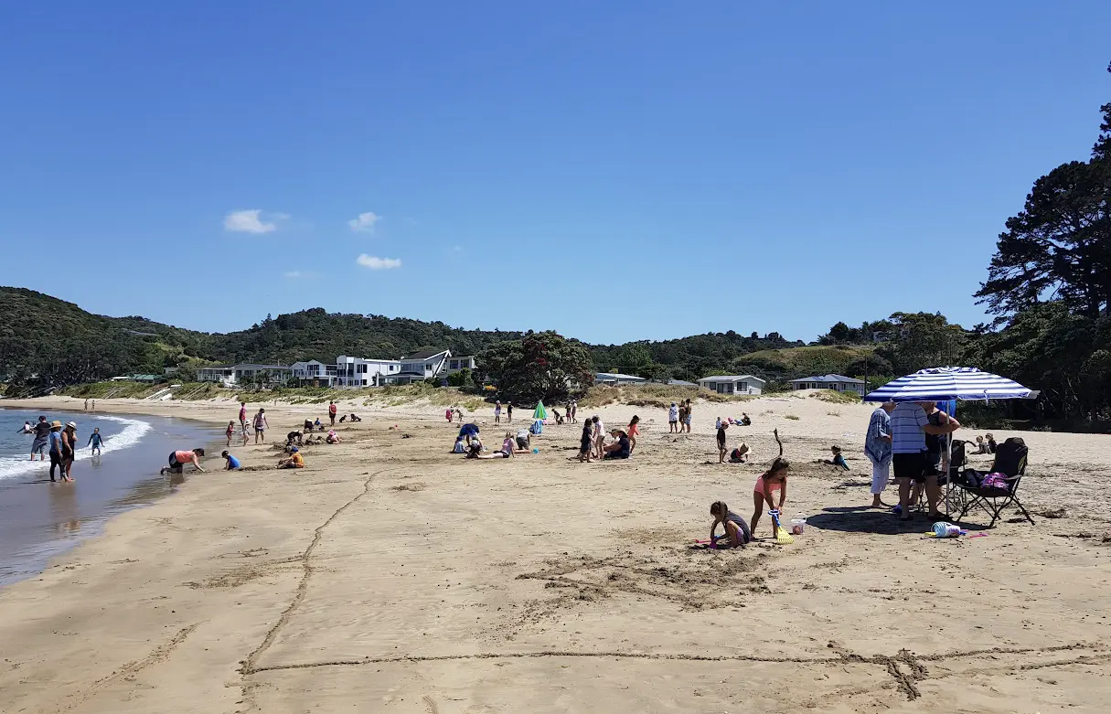
- Whananaki North Beach: Right in the village, this is a lovely family-friendly beach with an estuary that’s perfect for young kids to splash about in safely. At low tide, the sandspit is exposed, creating a huge playground for beach activities.
- Otamure Bay: Just north of Whananaki, this stunning white sand beach has a DOC campsite and is the starting point for the Watkin Powell Track, which leads to the secluded Tauwhara Bay – another beautiful swimming spot.
- Moureeses Bay: Further north, excellent for surfing, diving, and fishing. The rocky headland here offers good snorkelling when conditions are calm.
- Whananaki General Store: The village’s only shop, but it punches well above its weight. Good coffee, surprisingly decent food (the fish and chips come highly recommended), basic groceries, and the kind of local knowledge that’s worth its weight in gold. The shop also serves as the information hub and social centre of the village.
Environmental Protection
The Mermaid Pools situation is an important lesson for any discussion of hidden swimming spots in Northland. What was once pristine became polluted and damaged through over-visitation after becoming Instagram-famous. The Rock Hole has so far avoided this fate, partly because it requires a decent walk to reach and partly because it’s simply not as well-known.
However, that could change. Every time someone writes about a hidden spot (yes, including this article), there’s a risk of loving it to death. So here’s what we all need to do to make sure the Rock Hole doesn’t become the next Mermaid Pools:
- Take all rubbish with you. This isn’t negotiable. If you pack it in, pack it out. There are no rubbish bins, and there shouldn’t be.
- Don’t overcrowd it. If you arrive and there are already 20 people at the Rock Hole, consider visiting another beach. The lagoon can only sustainably handle limited numbers.
- No soap or sunscreen in the water. These chemicals are toxic to marine life in enclosed rock pools. Put sunscreen on before you start the walk, not at the pool. If you must use sunscreen at the Rock Hole, use reef-safe mineral formulations only.
- Respect the farm. The first section crosses private land that the landowners generously allow public access through. Don’t give them a reason to close it. Stay on the track, leave gates as you find them, don’t disturb stock.
- Share responsibly. If you post about the Rock Hole on social media, link to this article so people know the risks and are aware of their responsibilities when it comes to protecting this important place.
Cultural and Historical Context
The Whananaki area has deep significance for local Māori, particularly Ngātiwai and associated hapū. The name Whananaki itself comes from te reo Māori and refers to the coastal settlement that has been occupied for centuries. The surrounding lands, headlands, and waters have been used for fishing, gathering, and various customary activities for generations.
European settlement came later, with the area developing as a modest farming district. The Motutara Farm, through which the track passes, has been in the Barron family since 1915, representing over a century of family stewardship. The decision to establish the recreation reserve and allow public access through their farmland reflects a generous approach to land management that’s increasingly rare.
The footbridge connecting Whananaki North and South, built in 1947, represents the practical solution-focused approach typical of rural New Zealand communities. Rather than building an expensive bridge for vehicles or forcing children to make a long detour to get to school, the community built a footbridge that still serves its purpose 80 years later.
Photography Opportunities
The Motutara headland and Rock Hole offer excellent photography opportunities, though you’ll need to work for the best shots:
- The Walk Out: The views from the ridgeline looking back towards Whananaki harbour are stunning, particularly in late afternoon light. The white sand beaches below provide beautiful compositional elements.
- The Rock Hole: The turquoise water against dark rocks is genuinely photogenic. Early morning or late afternoon light is best. Midday sun creates harsh shadows and washed-out colours.
- Pohutukawa: During flowering season (late November through January), the red blooms against the blue water and sky are spectacular.
- Coastal Panoramas: The headland provides elevated viewpoints looking up and down the coast. On clear days, you can see from the Poor Knights Islands to Cape Brett.
- Wildlife: Bring a zoom lens if you’re interested in bird photography. The coastal clifftops and Pohutukawa trees provide good opportunities for native bird shots.
A waterproof camera or GoPro is worthwhile for capturing the underwater world while snorkelling. The water clarity means you can get excellent shots of marine life, rock formations, and the general underwater environment.
Planning Your Visit: Practical Timeline
Here’s a realistic timeline for a visit to the Rock Hole. You may want to adjust based on the tides.
- 8:00 am: Leave Whangārei (or your accommodation base)
- 8:45 am: Arrive at Whananaki, park at trailhead
- 9:00 am: Start walking
- 9:50 am: Arrive at Rock Hole (allowing for photo stops)
- 10:00 am – 12:30 pm: Swimming, snorkelling, exploring, having lunch
- 12:30 pm: Start walk back
- 1:15 pm: Return to car
- 1:30 pm: Drive to Whananaki General Store for refreshments
- 2:00 pm: Depart Whananaki
This gives you a good half day out while leaving the afternoon free for other activities. If you’re combining it with other Northland attractions, you could easily add Otamure Bay or Moureeses Bay in the afternoon.
What to Bring: Essential Checklist
- Sturdy walking shoes (essential, not optional)
- Reef shoes or old sneakers for rock pool exploration
- Togs (swimsuit), towel
- Snorkelling gear
- Sun protection: sunscreen (reef-safe), hat, sunglasses, rash vest
- At least 1-2 litres of water per person
- Snacks or packed lunch
- Rubbish bag (for packing out all waste)
- First aid kit basics
- Phone (for emergencies and photos, but don’t rely on coverage)
- Waterproof bag for electronics
- Camera
- Tide times (written down or screenshot, don’t rely on having coverage)
- Marine forecast (same as above)
Is It Worth It?
Absolutely, yes. The Rock Hole represents exactly the kind of experience that makes Northland special. Natural beauty that rewards those willing to make a bit of effort, relative solitude even in peak season, and that sense of discovery that’s increasingly rare in our Instagram-mapped world.
The walk itself is up and down and while not gruelling for someone reasonably fit, it could be challenging for those who don’t exercise regularly or have more limited mobility. The Rock Hole delivers on its promise of spectacularly clear water, dramatic rock formations, and excellent swimming and snorkelling. The various secluded beaches along the way provide bonus exploration opportunities.
Is it better than Otamure Bay or Moureeses Bay? Not necessarily better, just different. Those beaches offer easier access and perhaps more conventional beauty. The Rock Hole offers uniqueness, adventure, and the satisfaction of finding something special. If you have time, do both – they represent complementary aspects of what makes the Northland coast so remarkable.
The Rock Hole won’t be everyone’s cup of tea. If you’re looking for convenient access, sandy beach, lifeguards, and facilities, stick to the developed beaches. But if you’re willing to walk, carry your own supplies, and take responsibility for your own safety in exchange for a genuinely unique swimming experience, the Rock Hole is absolutely worth the journey.
Just remember that keeping special places special requires every visitor to act responsibly. Take your rubbish, respect the land, swim safely, and share thoughtfully. The Rock Hole has remained relatively unspoiled because it’s not overrun. Let’s keep it that way so future generations can experience the same sense of discovery and wonder that makes it such a treasure today.